
Lot n° 249
Estimation :
150 - 200
EUR
A CHART OF THE BRITISH CHANNEL, comprehending... - Lot 249 - Rossini
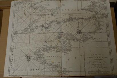
A CHART OF THE BRITISH CHANNEL, comprehending the Southern Coasts of England and Wales with the Coast of France by Th. Jefferys géographe du roi publié à Londres par R. Sayer. 52 x 66cm.
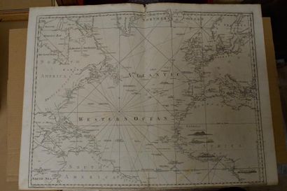
CARTE MARINE : ATLANTIC WESTERN OCEAN, a chart of the Atlantic ocean by Heather (?) 50 x 64,5cm.
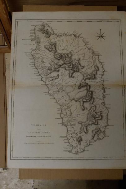
deux cartes marines fin XVIIIe et début XIXe, la première coupée au cuivre dans le haut et le bas, la seconde coupée sous le titre, nom du géographe non visible.
Pliures verticales médianes avec déchirures partielles et petits manques
Mes ordres d'achat
Informations sur la vente
Conditions de vente
Retourner au catalogue